
Image: Prof. Walter Timo de Vries presenting material on the utilization of geospatial technology.
Surabaya, F-ELECTICS – The development of geospatial technology increasingly plays a crucial role in data-driven public policy formulation. This was highlighted in an international guest lecture organized by the Department of Information Systems, Faculty of Intelligent Electrical and Informatics Technology (F-ELECTICS), Institut Teknologi Sepuluh Nopember (ITS) on April 7, 2026. The event featured an academic from Germany, Prof. Walter Timo de Vries.
In his presentation, Prof. Walter emphasized how geospatial research can be utilized to address sustainable development challenges. One of the main topics discussed was the concept of rural walkability, which refers to the analysis of accessibility and comfort in rural areas. This concept is further developed into a modern approach known as urban digital twins. This approach enables a digital representation of urban areas that can be continuously updated in real time based on spatial data.
The urban digital twins approach has become an important innovation in modern urban planning. By integrating geospatial data, sensors, and computing technologies, this system is able to virtually replicate real-world city conditions. It provides opportunities for governments and stakeholders to simulate policies before implementation, thereby minimizing risks of failure and improving decision-making effectiveness.
In addition, Prof. Walter highlighted the importance of interdisciplinary collaboration in developing this technology. The integration of information systems, geospatial science, and public policy is considered key to creating solutions that are adaptive to dynamic urban changes. In this context, institutions such as the Technical University of Munich play an important role in advancing globally relevant research.
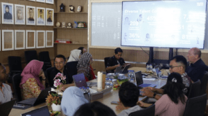
Image: Discussion with Prof. Walter Timo de Vries during the F-ELECTICS ITS international guest lecture on geospatial research and smart city development.
The enthusiasm of participants was clearly visible throughout the session. Students and lecturers actively engaged in discussions on the application of geospatial technology in Indonesia, particularly in supporting the development of smarter and more sustainable cities. These discussions provided new insights into how data can serve as the foundation for strategic decision-making in the digital era.
Through this event, the Department of Information Systems at ITS strengthens its commitment to providing international perspectives for the academic community. Beyond being a platform for knowledge transfer, this guest lecture also serves as a bridge to expand global research collaboration opportunities focused on developing data-driven spatial technologies for a more sustainable future.