ITS Campus, ITS News — Five sub-districts in Surabaya are predicted to be high-risk zones for dengue fever (DHF) in 2026 based on an analysis of the Aedes Aegypti Environmental Risk System (AERIS). Utilizing the Web Geographic Information System (WebGIS) and machine learning , the innovation developed by students from the Geomatics Engineering Department of the Sepuluh Nopember Institute of Technology (ITS) places the sub-districts of Tambaksari, Rungkut, Tandes, Sawahan, and Semampir as areas with a high-risk pattern for DHF.
AERIS development team leader Rifqi Pangestu Wiguna explained that the system was designed to identify areas with the potential for increased dengue fever cases. “Through this innovation, we are trying to shift our approach from responsive to preventive,” Rifqi explained.
To generate these predictions, Rifqi and his team processed data on dengue fever cases in Surabaya from 2019 to 2024 from the Surabaya City Health Office. The data was then combined with various variables such as rainfall, topography, population density, distribution of inundation points, and six other variables. Rifqi believes that the more relevant factors integrated into the model, the better AERIS’s ability to predict dengue fever risk.
The data was processed using four machine learning modeling methods : Random Forest, XGBoost, Support Vector Regression, and Negative Binomial Regression. “This combination of variables enables the system to present risk information to support data-driven decision-making,” explained the 2023 student.
The AERIS analysis results show that dengue fever risk is concentrated in areas with high population density. Furthermore, the presence of standing water was one of the most influential factors in the prediction model developed by his team. “Therefore, managing standing water and eliminating mosquito breeding sites remains a relevant measure,” Rifqi said.
Continuing his explanation, Rifqi explained that the model’s reliability was tested using actual dengue fever case data from March 2025, which was not included in the data training process. The model successfully identified nine of the ten districts with the highest number of cases. Bubutan, however, was the only district not identified, possibly due to temporary local factors such as an outbreak cluster.
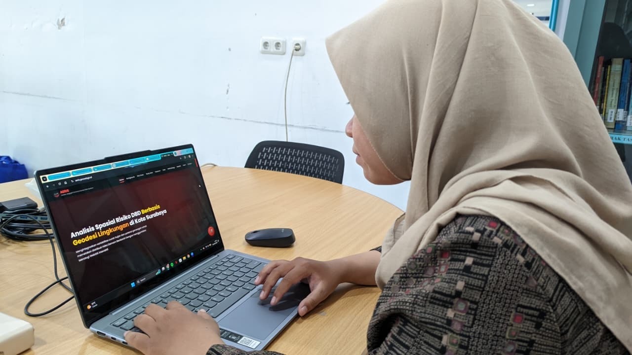
In addition to generating risk predictions, AERIS also presents information in the form of interactive WebGIS-based maps. Users can access visualizations of the distribution of dengue fever cases, rainfall, health facilities, and disease risk predictions at the sub-district level via aeris.geowebgis.id. “We hope AERIS will become a tool to support data-driven decision-making,” he concluded.
The development of AERIS aligns with ITS’s commitment to supporting the achievement of the Sustainable Development Goals (SDGs). This includes point 3 on Healthy and Prosperous Living through the provision of a dengue fever predictive model. Furthermore, the integration of flood vulnerability analysis into disease risk maps supports point 11 on Sustainable Cities and Settlements. (ITS Public Relations)
Reporter: Naurah Fitri
Translator: Devinka Mutianeira