Improving Navigation, ITS Professor Integrates GNSS with Various Aspects
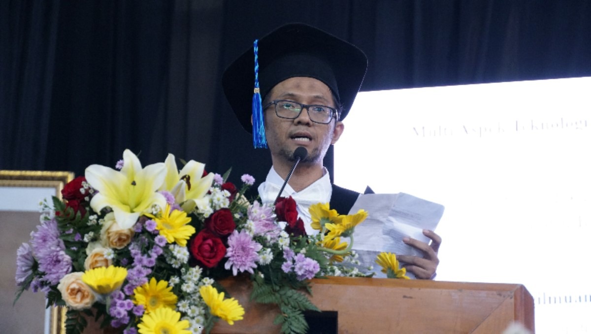
Prof Mokhamad Nur Cahyadi ST MSc PhD is presenting his scientific oration entitled Multi Aspects of Global Navigation Satellite System (GNSS) Satellite Technology for National Progress and Independence
ITS Campus, ITS News – Technological advances in the field of Global Navigation Satellite Systems (GNSS) have become the key to enabling long-distance navigation. Exploring this, research conducted by the 183rd Professor of the Institut Teknologi Sepuluh Nopember (ITS) Prof. Mokhamad Nur Cahyadi ST MSc PhD explored the potential for increasing GNSS performance through integration with other technologies.
This Geomatics Engineering Department lecturer, who is familiarly called Nur, has discovered the potential to sharpen GNSS navigation capabilities through integration with the Inertial Measurement Unit (IMU). Namely, an electronic device that measures the force, angular speed, and orientation of an object. The IMU works by detecting linear acceleration using an accelerometer and rotation rate using a gyroscope.
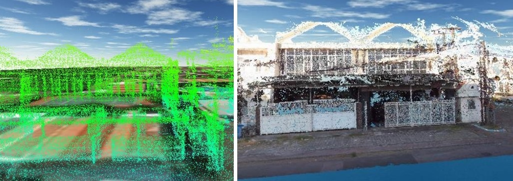
Display of the mobile mapping process using integration between GNSS, LiDAR, and Azure Kinect cameras as one initiated by Prof. Mokhamad Nur Cahyadi ST MSc PhD
Utilizing the Intelligent Boat (i-Boat) unmanned vessel developed by the ITS Directorate of Research and Community Service (DRPM) as a testing platform, Nur integrated GNSS with IMU using a loosely coupled integration type of sensor fusion. “In general, satellite positioning technology is only one aspect, but we are integrating it with various aspects for unmanned ships,” he said.
Thanks to this fusion, according to the Professor in the field of Global Satellite Navigation Systems, an increase in position accuracy reached 99.04 percent so that the ship’s location could be determined to an accuracy level of 0.025 meters. Such a high level of accuracy is required for an unmanned vessel of this kind to avoid obstacles and move autonomously.
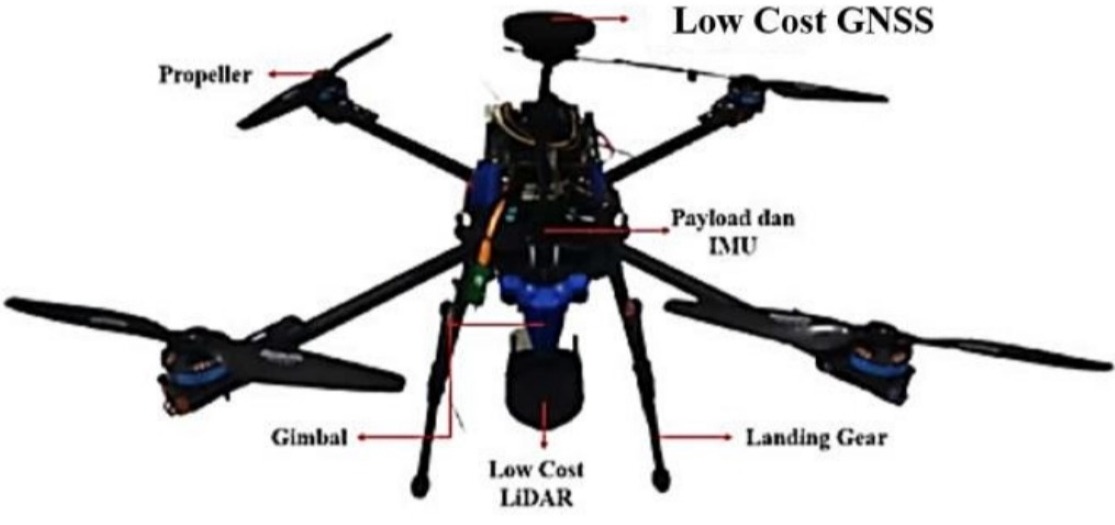
Integration between GNSS with LiDAR and IMU installed on a drone is currently in the development process
Not limited to IMUs, GNSS can be integrated with technologies such as Light Detection and Ranging (LiDAR). Different from previous IMUs, LiDAR measures the distance to an object by emitting a laser beam and then measuring the time it takes for the beam to return after hitting the object’s surface.
“The combination of these two technologies together with the Azure Kinect camera enables a process called mobile mapping which is used for land mapping and identifying changes in land and building use,” explained the lecturer who was born in Blitar, on December 23, 1981.
Professor of the ITS Geomatics Engineering Department, Prof. Mokhamad Nur Cahyadi ST MSc PhD when opening an activity
Developed in 2018 in a collaboration between the ITS Geomatics Engineering Department and ITS DRPM, this research has given birth to an innovative product in the form of the Low-Cost GNSS Smart Geo-PD tool. This tool, which has received a separate patent, is used by the Regional Drinking Water Company (PDAM) Surya Sembada Surabaya to map the position of water meters (geo-tagging) of PDAM consumers.
Apart from navigation and mobile mapping, Nur explained that GNSS technology could be developed to provide early warning of earthquake and tsunami disasters. Shortly before the disaster occurs, there is generally a release of energy in the form of acoustic waves from the earth’s surface into the atmosphere. This event is called ionospheric disturbance.
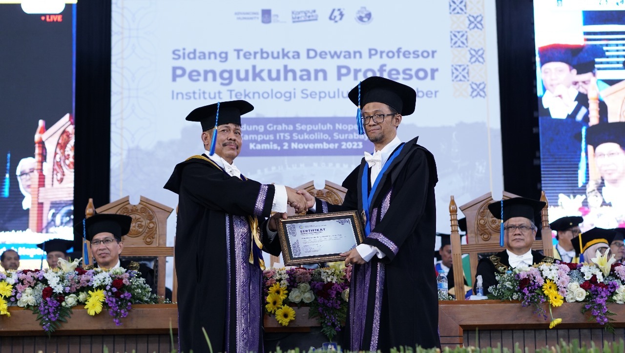
Chair of the ITS Professorial Council Prof. Dr. Ir Imam Robandi MT (left) handed over the certificate of inauguration of ITS’s 183rd Professor to Prof. Mokhamad Nur Cahyadi ST MSc PhD
The epicenter of the earthquake emits three types of waves, namely Rayleigh waves, acoustic waves, and internal gravitational waves. Looking at the case of the Palu earthquake that occurred in 2016, ionospheric disturbances could be detected around 13 minutes after the start of the earthquake. However, the tsunami occurred around 20 – 35 minutes after the earthquake. “This provides a short time to evacuate people before the tsunami hits the coast,” added the former Head of the ITS Geomatics Engineering Department.
Overall, this research has resulted in eight patents, two trademarks, one industrial design, and nine copyrights. As time goes by, Nur hopes to make continuous improvements and even launch new innovative products. “If we spread it to companies or the public, there will be input, suggestions, and complaints, and the innovation will never stop,” he concluded. (ITS Public Relations)
Reporter: Kevin Bahari Pratama
Related News
-
Gerigi ITS 2024, a Spark of Enthusiasm for Freshmen Contributions
ITS Campus, ITS News — Institut Teknologi Sepuluh Nopember (ITS) again held Generasi Integralistik (Gerigi) as a place to
December 08, 2023 20:12 -
ITS Team Wins the Sustainable Bridge Competition 2024 Event
ITS Campus, ITS News — Students of Institut Teknologi Sepuluh Nopember (ITS) again made brilliant achievements in the construction field.
December 08, 2023 20:12 -
Supports Learning, FKK ITS Establishes Technology Display and Digital Cadaver
ITS Campus, ITS News — The commitment of Institut Teknologi Sepuluh Nopember (ITS) to continuously improve the quality of
December 08, 2023 20:12 -
ITS, QUT, and UTS Collaborate to Enhance Flood Resilience
ITS Campus, ITS News — Institut Teknologi Sepuluh Nopember (ITS), together with Queensland University of Technology (QUT) and the
December 08, 2023 20:12