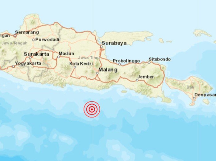
ITS Campus, ITS News – Natural disasters seem to have hit almost all regions in Indonesia in turn, lately. This time, Indonesia was again shocked by an earthquake. With a magnitude of 6.7, which rocked the Malang Regency at around 14.00, Saturday (10/4).
According to a senior researcher from the Research Center for Disaster Mitigation and Climate Change (Puslit MKPI), ITS Dr. Ir Amien Widodo MSi, the cause of this earthquake was due to the activity of the subduction zone formed due to the collision of the Indo-Australian plate with the Eurasian plate. The plate collision occurred about 200 kilometers from the southern coast of Java. “Because of the oblique position of the collision, an earthquake occurred along the path of the collision of the two plates,” explained the lecturer at the ITS Geophysical Engineering Department.

Amien said that this incident is a common thing considering Indonesia’s geographic location is at the junction of the three main world plates, namely Eurasia, Indo-Australia, and the Pacific. Based on data from the East Java Regional Disaster Management Agency (BPBD), this earthquake that did not have the potential for a tsunami was felt in 17 districts/cities in East Java.
Reporting from the Meteorology, Climatology and Geophysics Agency (BMKG), the epicenter was 90 kilometers southwest of Malang Regency and was centered in the Banda Sea off the coast with a depth of 25 kilometers. “This earthquake point is a common cause of earthquakes in the surrounding area,” said Amien Widodo.
Amien said that the collision of the two plates continued to experience a shift of up to 7 centimeters per year. The shift will continue until a part of the collision breaks and causes an earthquake. “The collision path is from Banten to Banyuwangi,” said the alumnus of Gadjah Mada University.
Luckily, the 6.7 on the Richter scale earthquake did not have the potential to cause a tsunami. This is because the layer shift occurs horizontally and does not cause high sea waves.
Finally, Amien Widodo hopes that all Indonesian people will be more vigilant and recognize the potential for natural disasters to be able to minimize casualties. “Indonesia is located in an area prone to natural disasters, so the community must be able to recognize these threats and adapt to them,” he reminded. (pan/ITS Public Relations)
Reporter: Frecia Elrivia Mardianto