Builds Village Mapping, ITS Students Develop Java Drone Service
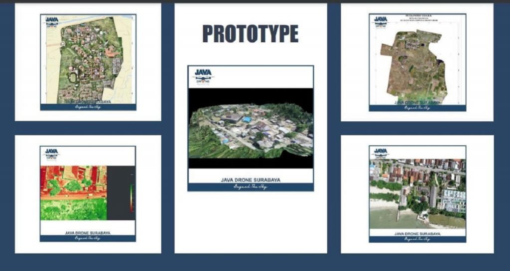
Java Drone prototype designed by the ITS student team
ITS Campus, ITS News – Since President Joko Widodo announced the One Map Geoportal Policy , adding thematic maps to resolve overlapping land uses in the village needs to be done. As a follow-up to this problem, students of the Department of Geomatics Engineering, Institut Teknologi Sepuluh Nopember (ITS) designed an innovation in the form of a geospatial service provider called Java Drone.
They are Moh Faisal, Shaza Flanetta Putri, and M Hidayatul Ummah. The three of them started the Java Drone design after seeing a large business opportunity for mapping services. The mapping uses Unmanned Aerial Vehicle (UAV) technology or what is commonly called a drone. “We view that currently, the map has become a development urgency,” said Moh Faisal, the team leader.
Therefore, continued the student who is usually called Faisal, Java Drone is here to solve various mapping problems in Indonesia. Previously, Faisal and his team had conducted market segmentation research to find out which party to target in this business offers. “After that, product development is carried out so that Java Drone has state of the art,” he explained.
Faisal admitted that Java Drone is focused on two-dimensional (2D) and three-dimensional (3D) mapping. Some of the products launched by Java Drone include Area Mapping, a type of topographic mapping. 3D Modeling, 3D modeling specifically for endangered nature reserves, tree counting, plant health, documentation, and videogrammetry.
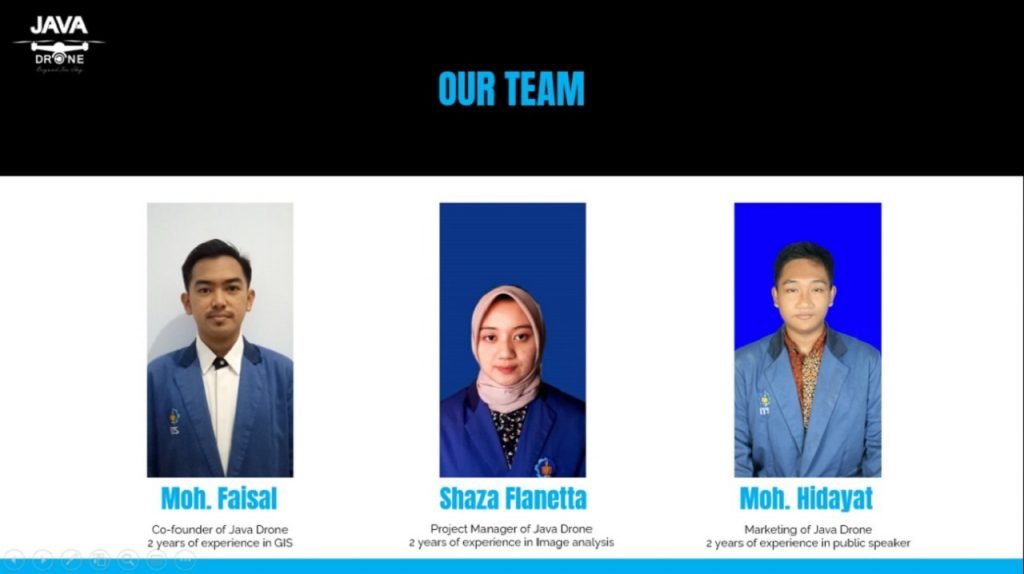
ITS students as the members of the Java Drone initiator team
“Then, we developed three more products, namely inspection, 3D smart village, and a Geographic Information System (WebGIS) application. So now there are nine products, “added the Madurese youth. With these various things, he added, work becomes more effective and can cut costs.
Java Drone has been applied to several underdeveloped villages, including Ngepung Village, Nganjuk; Lojejer Village, Jember; Banjarasri Village, Sidoarjo; Kedungbanteng Village, Sidoarjo; and several other villages. “Until now, we are still making bids to several underdeveloped villages,” said the student who was born on October 18, 1999.
Thanks to this innovation, their team has also succeeded in winning a championship in the 2020 Business Plan Competition (BPC) held by the Medan State University, early November. “As the only delegation from ITS, we were guided by a Geomatics Engineering lecturer, Mr. Khomsin ST MT, in developing this product,” he said.
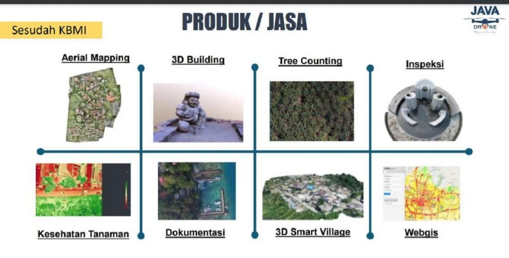
Java Drone Products and Services, designed by the ITS students’ team
Even so, this young man in glasses admitted to having experienced several obstacles, such as low understanding when making offers to government agencies, lack of market education to target markets, and the absence of a companion when marketing Business to Government (B2G). “Also, the Covid-19 pandemic has also had a major effect on hampering the development of this product,” he admitted.
In the future, Faisal targets to develop WebGIS, which was previously static to dynamic. “This means that we will integrate the existing maps in the village so that all people can access them and help in making 3D smart villages,” he explained again.
Faisal hopes that Java Drone can realize the vision to become the largest drone-based survey company in Indonesia and provide accurate detail so that planning and development can be more effective and on target. “Besides, we also want Java Drone to be a start-up that answers all problems, especially in the geospatial field,” he concluded. (chi/man/ITS Public Relations)
Related News
-
ITS Rises to Second Rank in Most National PKM Funding
ITS Campus, ITS News – Strengthening its determination in the scientific field, the Institut Teknologi Sepuluh Nopember (ITS) succeeded
December 02, 2020 17:12 -
Examining Kenny, the Best ITS Bachelor Graduate with a GPA of 3.94
ITS Campus, ITS News — Educating for 3.5 years at the Institut Teknologi Sepuluh Nopember (ITS) did not prevent Benedictus
December 02, 2020 17:12 -
Inspirational, Deaf ITS Graduates Graduated with Cumlaude Predicate
ITS Campus, ITS News — An inspiring story was also present at the 129th Graduation Ceremony of the Institut Teknologi
December 02, 2020 17:12 -
129th Graduation: ITS Graduates 1,355 Candidate Leaders
ITS Campus, ITS News – Institut Teknologi Sepuluh Nopember (ITS) again held a graduation procession for its students through the
December 02, 2020 17:12